


guadeloupe saint martin geand case

Loic Le Meut
User

Length
300 km

Max alt
130 m

Uphill gradient
1163 m
Km-Effort
315 km

Min alt
-2 m

Downhill gradient
1167 m
Boucle
No
Creation date :
2021-07-08 13:20:44.075
Updated on :
2021-07-08 14:10:02.91
48m
Difficulty : Very easy

FREE GPS app for hiking
 SityTrail
IGN / Geographical institutes
SityTrail Plus
The world is yours!
About
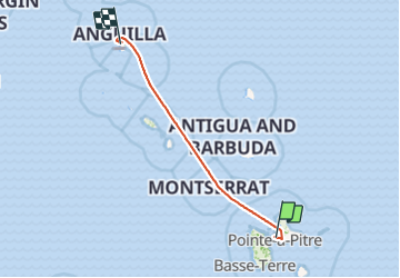
Trail Plane of 300 km to be discovered at Guadeloupe, Unknown, Les Abymes. This trail is proposed by Loic Le Meut.
Positioning
Country:
France
Region :
Guadeloupe
Department/Province :
Unknown
Municipality :
Les Abymes
Location:
Unknown
Start:(Dec)
Start:(UTM)
657087 ; 1799414 (20Q) N.
Comments